Our Services

Participatory Mapping

Launch place-based campaigns, collect live responses, and analyse the patterns to prioritise what to act on. All in City Layers Studio.

How we work with you

Choose the right
level of support.

Launch a participatory map, collect responses as they come in, and see the patterns that tell you what to act on.
Run it yourself or work with our team.

There are no crosswalks on this street.
There isn't enough shade to sit in the park.
Night lights are not working.
Hover to gather the voices
Expert-led

Service Campaigns

A complete community engagement service that brings local knowledge into urban design, planning and place-based decisions.

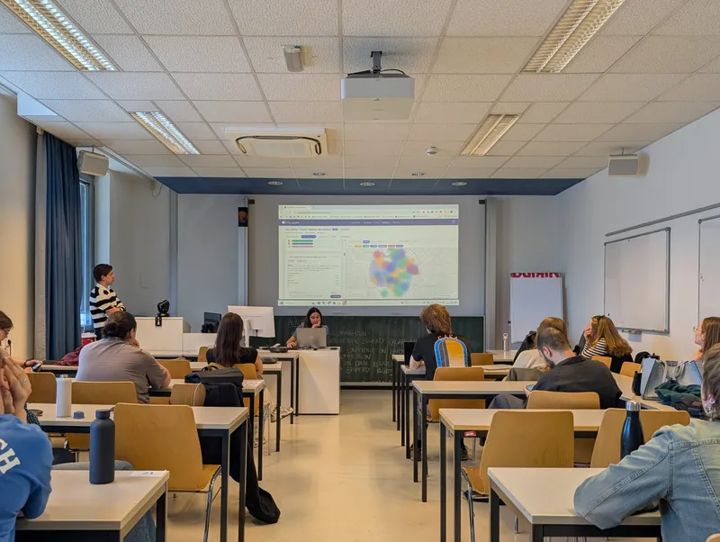
Our team designs and delivers a complete participatory mapping campaign, supports participation, analyses community input, and presents clear findings and priorities. We manage the process while keeping your team involved throughout.

  • An engagement strategy tailored to your place, audience and goals
  • Full design and delivery of the participatory mapping campaign
  • Support across digital, on-site and workshop formats
  • Collection of location-specific community input
  • Spatial analysis to reveal patterns, needs, challenges and opportunities
  • Clear action priorities and practical recommendations for planning and decision-making
  • A final report with key findings, maps and data
Mobility
Green space
Safety
Hover to peel the layers apart
Self-managed

Platform Access

A map-based community engagement platform for organisations running their own projects and campaigns. You run it yourself.

Create and publish your own map-based campaigns, invite people to contribute on site or remotely, and watch the results come in. Responses become patterns, dashboards, and reports automatically; everything in one platform. Your team runs it independently, with onboarding and support from us.

  • A dedicated workspace for running and managing map-based campaigns
  • Campaign creation adapted to different needs - built from scratch, step by step or with a conversational assistant, or starting from our library of customisable templates for any project, topic or target group
  • Easy participation through shareable links and QR codes
  • A live dashboard for monitoring and managing contributions
  • Built-in tools for analysing data, revealing spatial patterns and identifying action priorities
  • Exportable data, maps and reports for planning and decision-making
  • Onboarding and ongoing platform support
Use Cases

Participatory mapping leads to better outcomes.

From mobility plans to research projects, City Layers works wherever people's experience of a place needs to be understood, measured, and acted on.

Filter by sector
Spatial Reporting Interfaces
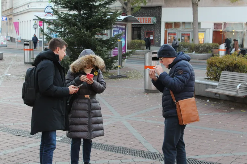
Live Map and Phone

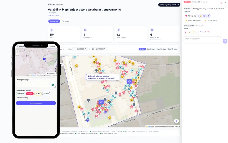
City Layers gives residents a live map to report issues, concerns, and suggestions exactly where they occur, so city teams see a real-time picture instead of scattered complaints. This is platform-led, with optional campaign support for launch and ongoing moderation.

What City Layers Delivers
  • Live issue map

    A real-time view of where public space issues are reported as they happen.

  • Maintenance prioritisation

    Clear evidence for deciding what to fix first and where.

  • Resident-to-team channel

    A direct line between what residents notice and where city teams act.

Where This Applies
Issue Reporting Neighbourhood Improvement Maintenance Prioritisation Safety Reporting Community Concern Mapping Local Action Planning
Community Engagement in Mobility Planning
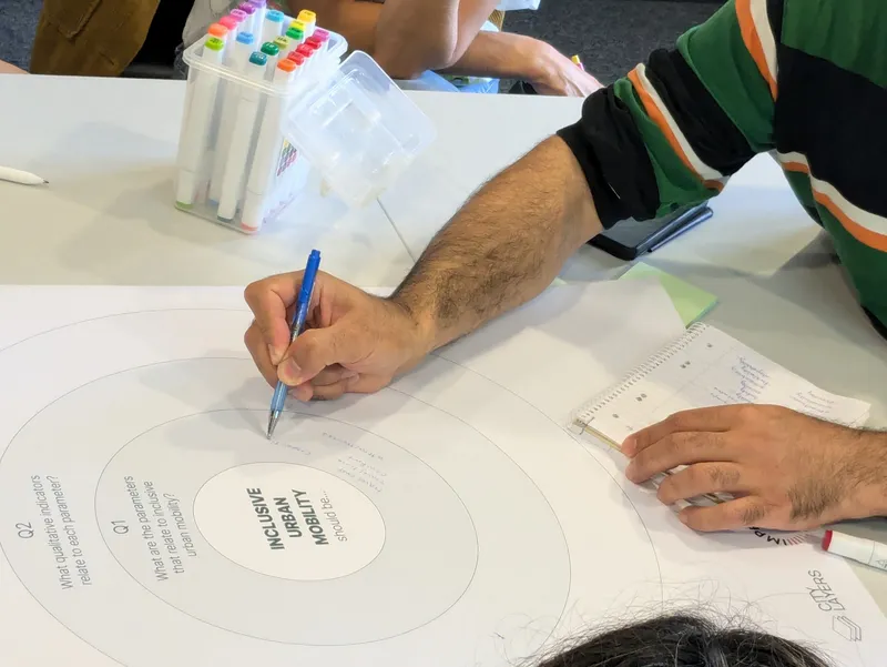
Mobility Workshop

City Layers fills that gap with spatially precise community input, mapped directly onto the routes and junctions in question. This works best as campaign-led workshops for a specific project, with platform access if you want to track mobility issues across multiple plans over time.

What City Layers Delivers
  • Priority map

    Where mobility barriers and safety concerns are concentrated, ranked for action.

  • Evidence for SUMP and funding applications

    Community-validated input ready to feed into planning and funding submissions.

  • User group needs

    A clear view of which groups, children, older residents, wheelchair users, face the biggest barriers, and where.

Where This Applies
SUMP Cycling Networks Pedestrian Paths Street Redesign School Mobility Climate Comfort Perceived Safety Mobility Barriers
Community Engagement in Urban Planning and Design
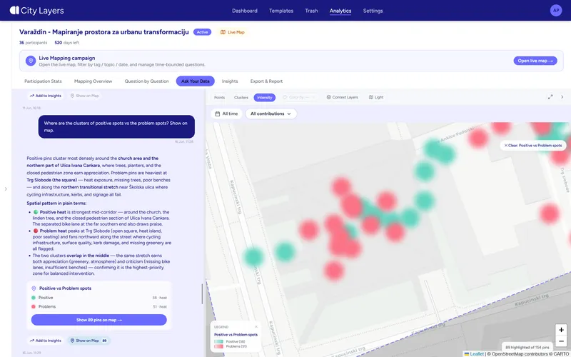
Citizen Sentiment in Themes

City Layers fills that gap with spatially precise community input, collected directly on-site and mapped against the project area. This works as campaign-led engagement for a single project, with platform access if you're running consultation processes across multiple planning projects.

What City Layers Delivers
  • Mapped community insights

    Where residents value, avoid, or raise concerns about specific areas within the project site.

  • Priority locations

    A ranked view of where design or planning interventions matter most.

  • Actionable recommendations

    Input structured for direct use in design and planning decisions, not just a consultation report.

Where This Applies
Public Space Redevelopment Street Redesign Masterplans District Planning Urban Regeneration Accessibility Studies Climate Comfort Perceived Safety
Public Space and Street Redesign
Citizen Street Redesign

City Layers collects that evidence directly on-site: comfort, safety, accessibility, and use patterns mapped against the exact area under redesign. This works as campaign-led engagement during the design process, with optional platform access for ongoing input afterwards.

What City Layers Delivers
  • Spatial evidence

    Comfort, safety, accessibility, and use-pattern data mapped to the specific site.

  • Priority areas

    A clear view of where the redesign should focus first.

  • Community-backed design

    Input collected directly from the people who use the space, ready to support the proposal.

Where This Applies
Street Redesign Park Regeneration Square Revitalisation Tactical Urbanism Climate Adaptation Accessibility & Comfort
Visitor Experience in Large Sites
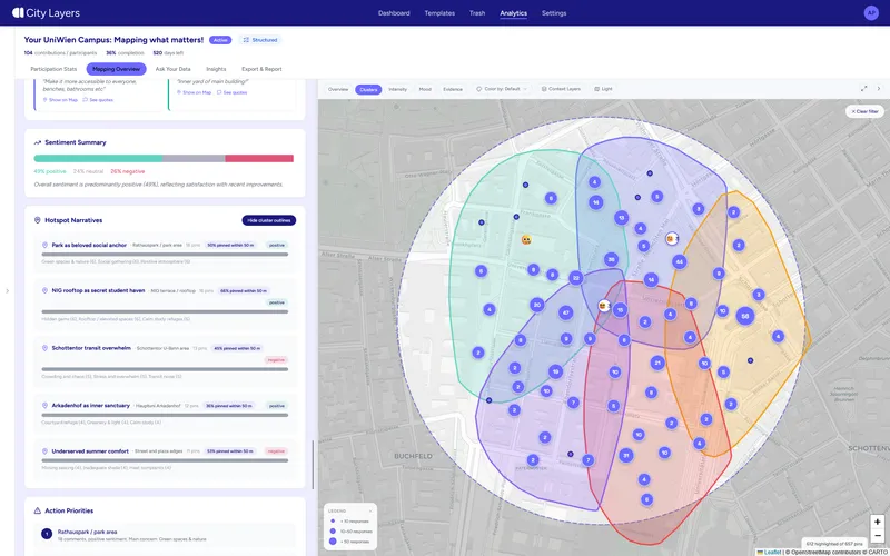
Citizen Sentiment Positive & Negative

City Layers maps that experience directly onto the site, surfacing wayfinding issues, comfort concerns, and accessibility gaps as they occur. This works platform-led for ongoing monitoring, or hybrid with City Layers supporting campaign design and reporting.

What City Layers Delivers
  • Spatial pattern map

    A clear view of where visitor experience works and where it breaks down.

  • Wayfinding and accessibility insight

    Specific issues mapped to specific locations on-site.

  • Continuous monitoring

    Ongoing visibility into experience as the site changes over time.

Where This Applies
Visitor Experience Wayfinding Accessibility Mapping Comfort & Safety Site Management Experience Monitoring
Community Development and Neighbourhood Work
Underrepresented Groups

City Layers gives them a live map to collect needs, concerns, and ideas directly from residents, including groups that are usually underrepresented in formal consultation. This is platform-led, with optional campaigns for ongoing neighbourhood engagement.

What City Layers Delivers
  • Neighbourhood needs map

    Clear spatial patterns showing where needs are concentrated.

  • Local priorities

    A structured basis for deciding what to act on first.

  • Evidence for funders and partners

    Action-oriented insights ready to support proposals and reports.

Where This Applies
Neighbourhood Engagement Community Needs Assessment Local Inclusion Social Infrastructure Mapping Underrepresented Groups
Research and Field Data Collection
Uni Mapping

City Layers gives research teams a ready-made platform for collecting spatial observations directly in the field, structured from the start so it's usable for analysis and publication. This is platform-led, built to support studies rather than one-off surveys.

What City Layers Delivers
  • Structured spatial datasets

    Field observations organised and ready for analysis, not raw notes to clean up later.

  • Visualisations

    Clear spatial outputs to support findings.

  • Publication-ready outputs

    Results structured for academic or applied reporting.

Where This Applies
Citizen Science Urban Research Mobility Research Climate Comfort Studies Accessibility Studies Participatory Mapping

Who We Work With

City Layers serves a broad range of clients across the public and private sectors

Urban Planning & Community Development

Making community engagement accessible, measurable and actionable in urban design, planning and development: building trust, fostering communication and reducing risks.

Key Stakeholders
Urban Designers Participatory Planners Real-Estate Developers

Municipalities & Public Sector

Supporting cities and municipal departments in running public participation in spatial planning and urban decision-making.

Key Stakeholders
Municipal Departments District Planning Offices Public Space Managers

Mobility & Transport Operators

Helping mobility planners and transport operators understand where infrastructure and passenger experience fall short, from cycling networks to station floors.

Key Stakeholders
Mobility Planners Transport Operators Station Managers

Community & Civic Organisations

Helping organisation run their participatory activities, making workshops, on-site sessions, and remote community work measurable, impactful and actionable.

Key Stakeholders
Community Department NGOs Neighbourhood Management

Academia & Research Institutions

Providing researchers with a flexible tool for collecting and analysing field data and involving communities in their research.

Key Stakeholders
Universities Research Institutes Citizen Science Projects

Let's Work Together

Tell us about your project and we'll find the right approach for your community.