In June 2026, City Layers carried out a participatory mapping study across three
interconnected public spaces in central Varaždin: Ulica Ivana Cankara, Trg Slobode and
Ulica Anice Opolski. Designed as a rapid, early-stage spatial screening rather than a long
community engagement process, the project examined how people experience the area
before potential spatial interventions are defined. During a guided on-site walk, participants
evaluated mobility and perceived thermal comfort throughout the site. They responded to
themed questions and pinned observations, experiences and ideas directly to the City
Layers community map.
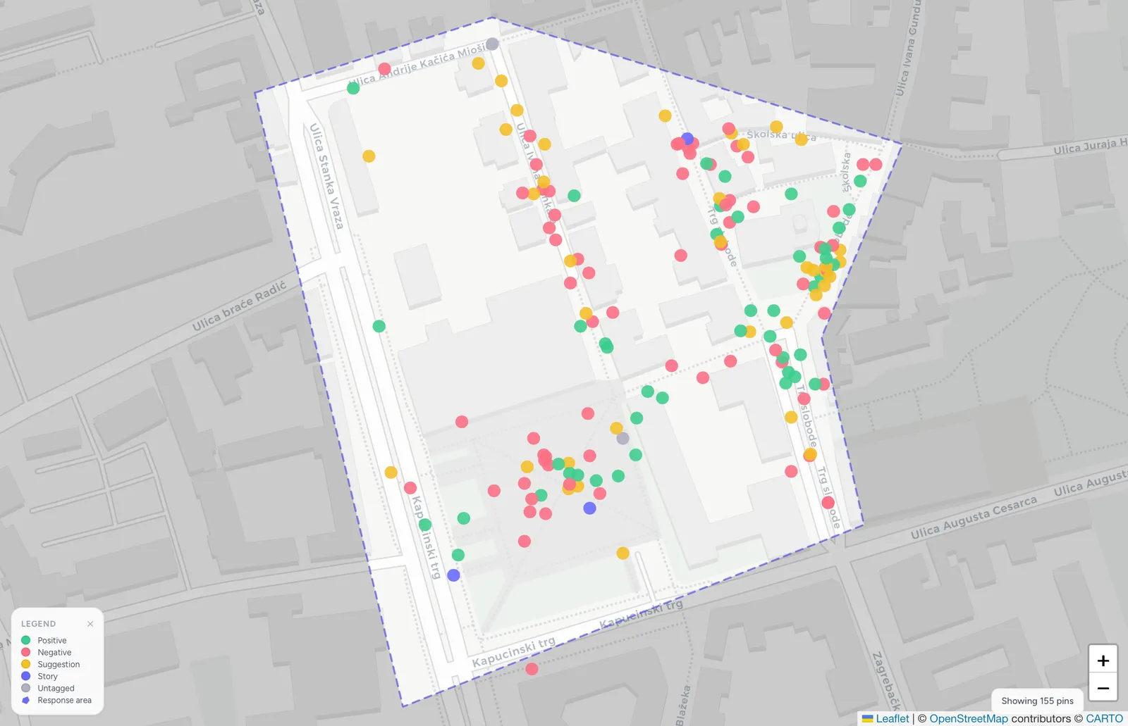
Figure 1. Mapped contributions: 154 pins across the study area, including positives, issues, suggestions and story-based contributions.
The mapping revealed clear recurring themes and spatial patterns. The strongest concern
was the lack of greenery and shade, particularly across larger paved areas. Additionally,
participants highlighted inconsistencies in cycling infrastructure, insufficient seating and
urban furniture, and localised issues with surface quality and accessibility. At the same
time, participants repeatedly valued existing trees and greenery, pedestrian areas and
well-designed sections of cycling infrastructure. The map showed that positive and critical
experiences often occurred close together, identifying places where targeted
improvements could build on qualities that already work.
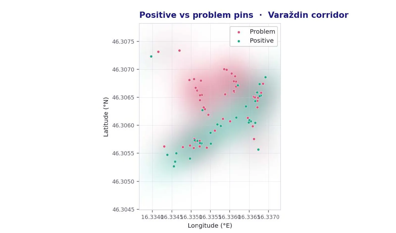
Figure 2. positive vs problem pins: Indicative split over the 154-pin export; platform totals are 38 positive and 51 problem.
The mapped contributions were consolidated into a full study report combining thematic
and spatial analysis, participant profiles, limitations and recommendations for spatial
redevelopment. Rather than defining a final design solution, the report provides an
evidence base for further planning: showing which issues deserve closer attention, where
targeted interventions could have the greatest value, and where deeper investigation and
broader resident engagement should follow.
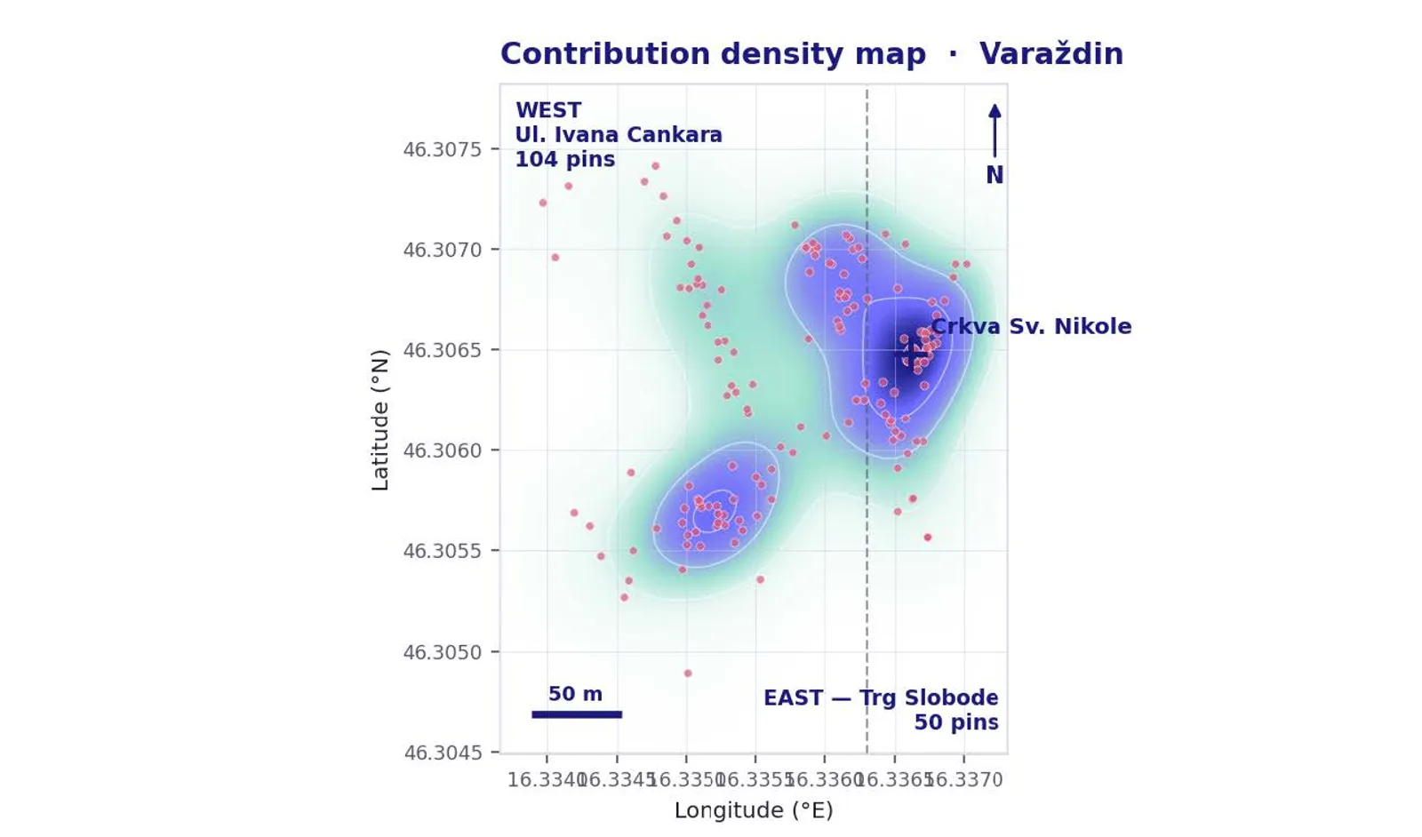
Figure 3. Contribution density: the densest single cluster sits by the Church of St. Nicholas in the east.