Revealing Urban Complexities through Everyday Experiences
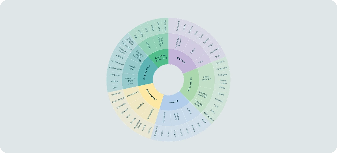
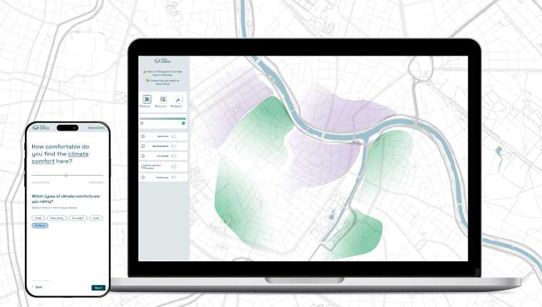
City Layers is a transdisciplinary framework that translates complex urban phenomena into accessible layers of everyday experience. Our citizen science methodology bridges community insights with expert knowledge, while our digital platform -the core of the project- enables intuitive participatory mapping and sophisticated data visualization. This transformative process converts subjective urban experiences into actionable intelligence, empowering citizens and decision-makers to collaboratively shape more responsive and equitable urban environments.
Explore
We transform urban complexity into everyday citizen insights
through four integrated approaches
Our collaborative journey of developing City Layers from concept to platform, involves co-creation workshops, field testing, methodological refinement and digital tool advancement —all shaped by and designed for the communities who bring the system to life.
Participate to map mobility barriers in places around you!
Add a pinOrchestrates the strategic vision and execution of City Layers, ensuring the coordination across research, technical, and design components. Lovro ensures project milestones are met while maintaining strategic alignment with research objectives.
Transforms research insights into functionalities of the City Layers platform. Domagoj oversees the evolution of City Layers from conceptual prototype to polished platform, focusing on user experience and feature development.
Leads City Layers’ transdisciplinary methodology, integrating expert knowledge and community insights into urban data collection. Androniki devises the projects’ interactive foundation, including expert workshops, mapping processes and data dashboard interface.
Bridges technical implementation with project goals. Angelos guides the technical development of City Layers, optimizes workflows, and ensures technological solutions effectively address complex urban visualization challenges.
Crafts the code architecture behind City Layers' visualization capabilities. Stasja develops robust back-end systems and data processing frameworks that power the project's interactive mapping features.
Provides strategic guidance on citizen science approaches and academic integration. Eveline ensures City Layers maintains scientific rigour while facilitating knowledge transfer between research domains.
Reach out to collaborate, contribute data, or explore how
City Layers can illuminate your neighbourhood's unique spatial story.